

© 2026 Visit San Antonio. All Rights Reserved.


© 2026 Visit San Antonio. All Rights Reserved.
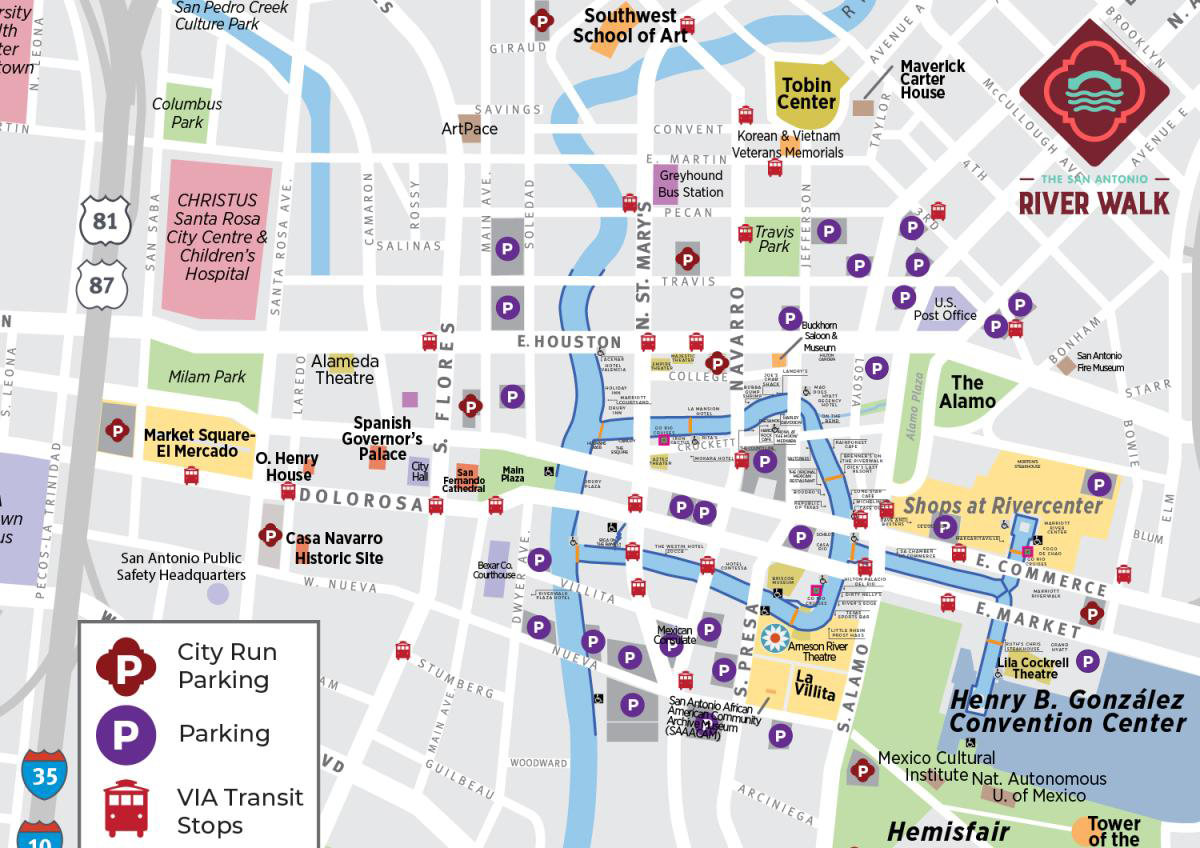
Find parking areas near Downtown River Walk attractions, restaurants, and hotels.

Review accessible entrances and routes around the Downtown River Bend.
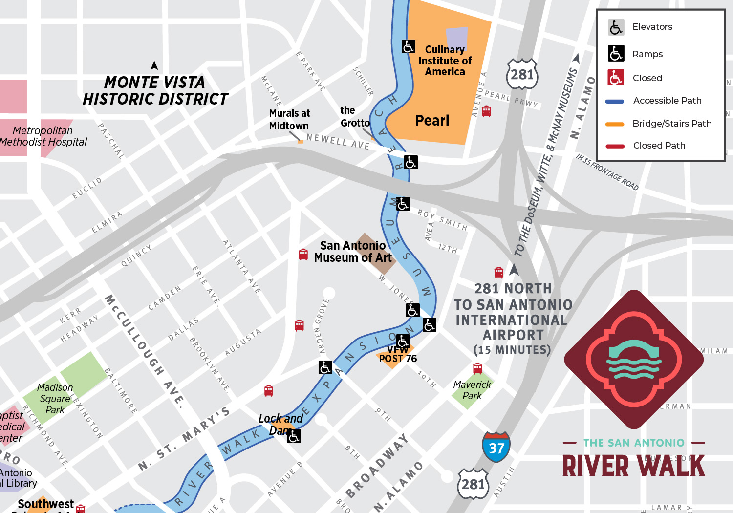
Plan your visit to Museum Reach with a map highlighting accessibility information.

Explore additional sections of the River Walk using a map provided by the San Antonio River Authority.
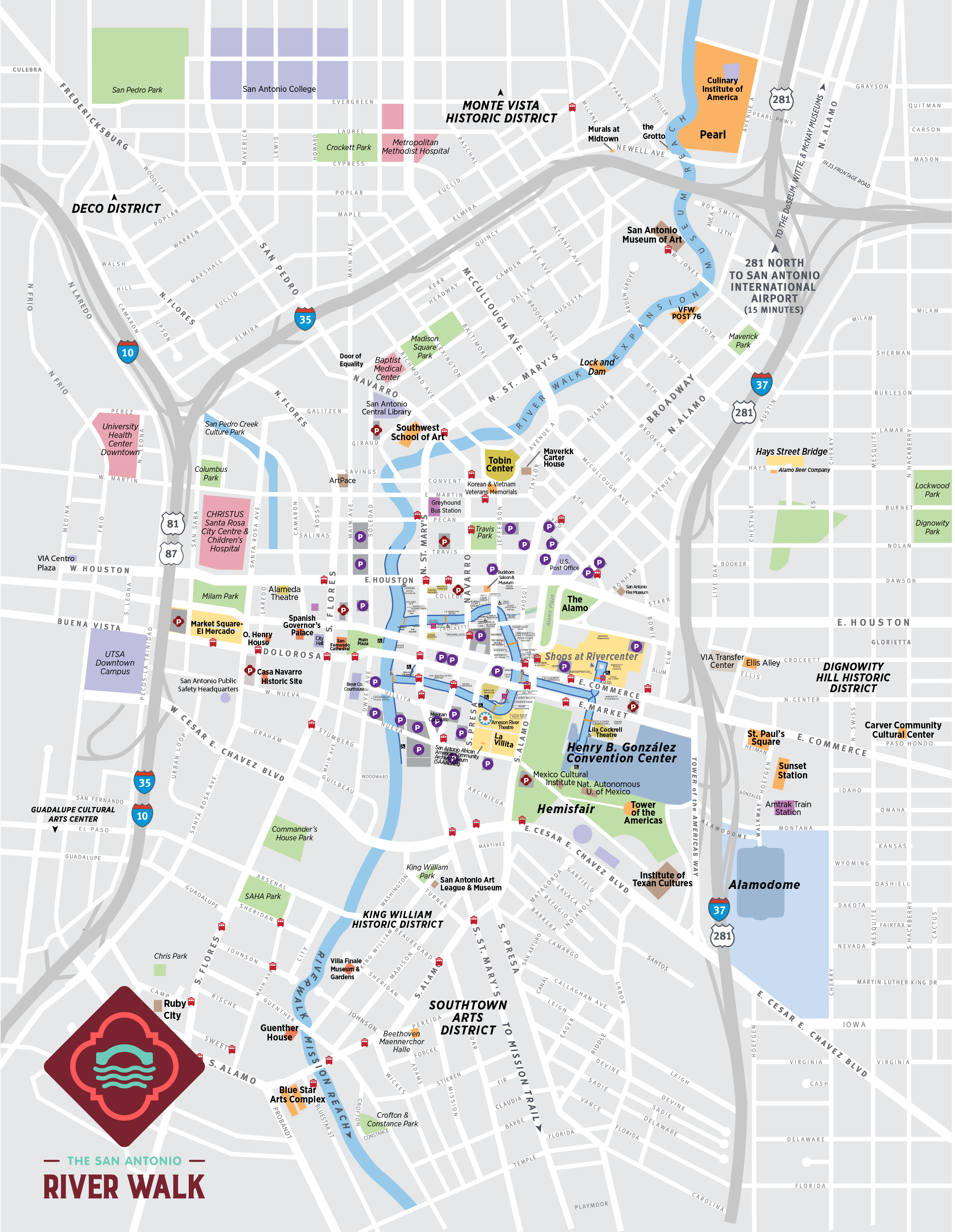
Get an overview of Downtown River Walk pathways and nearby destinations.

October is one of the most colorful times to experience the San Antonio River Walk! From vibrant Día de los Muertos celebrations and festive…

From family lunches to date nights, find a dining stop for your 2026 San Antonio getaway. A great vacation leaves room for a few delicious detours…

The San Antonio River Walk is a vibrant, family-friendly destination that offers a variety of activities for all ages. Spanning 15 miles, the River…

The Hispanic Heroes art installation on the San Antonio River Walk celebrated the musicians, mentors, and community leaders who helped shape San…

Planning a trip to San Antonio this September? Make the San Antonio River Walk part of your itinerary with scenic river cruises, patio dining, public…

